---
---
--:--:--PM
--:--:--PM
Logan Intl (BOS) airport maps
Maps of Logan Intl, USA
Terminal map Download Interactive map Route & destination map
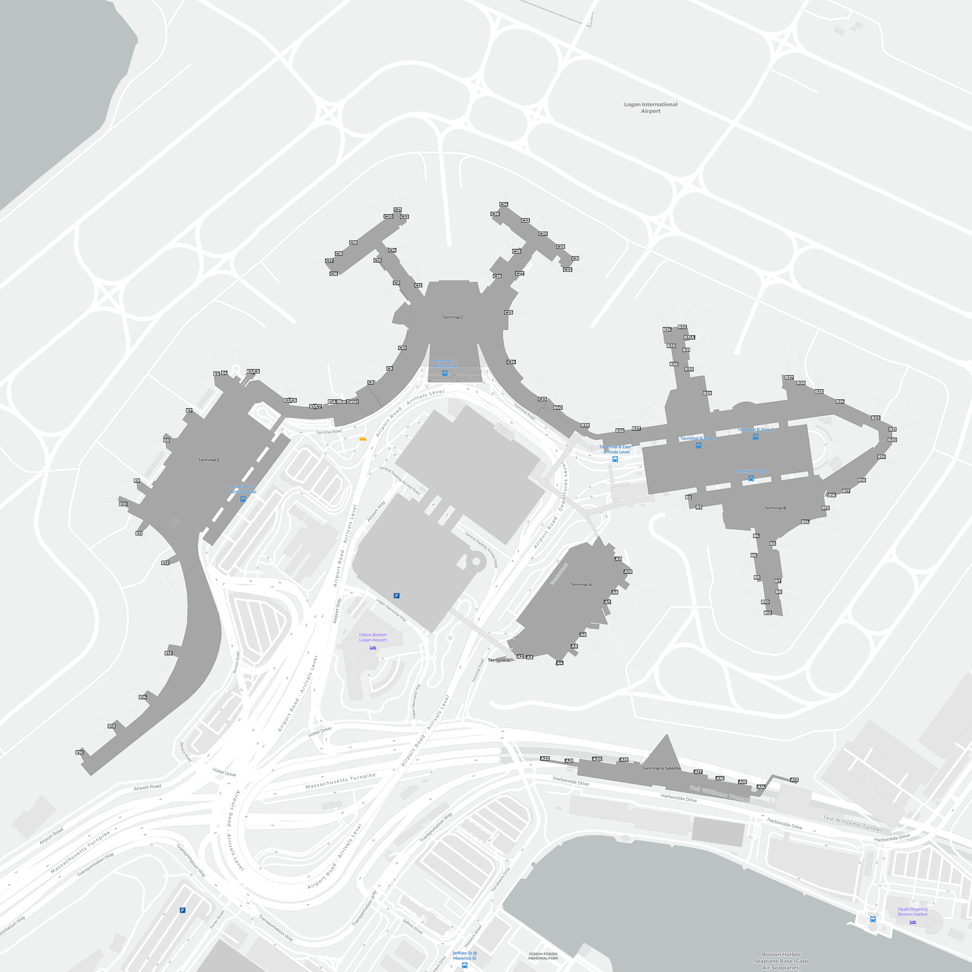
Logan Intl Terminal map
 Open larger map in a new window
Download PDF (999 KB)
Download PNG (1.3 MB)
Click on the download button above to download the map as a printable offline PDF map.
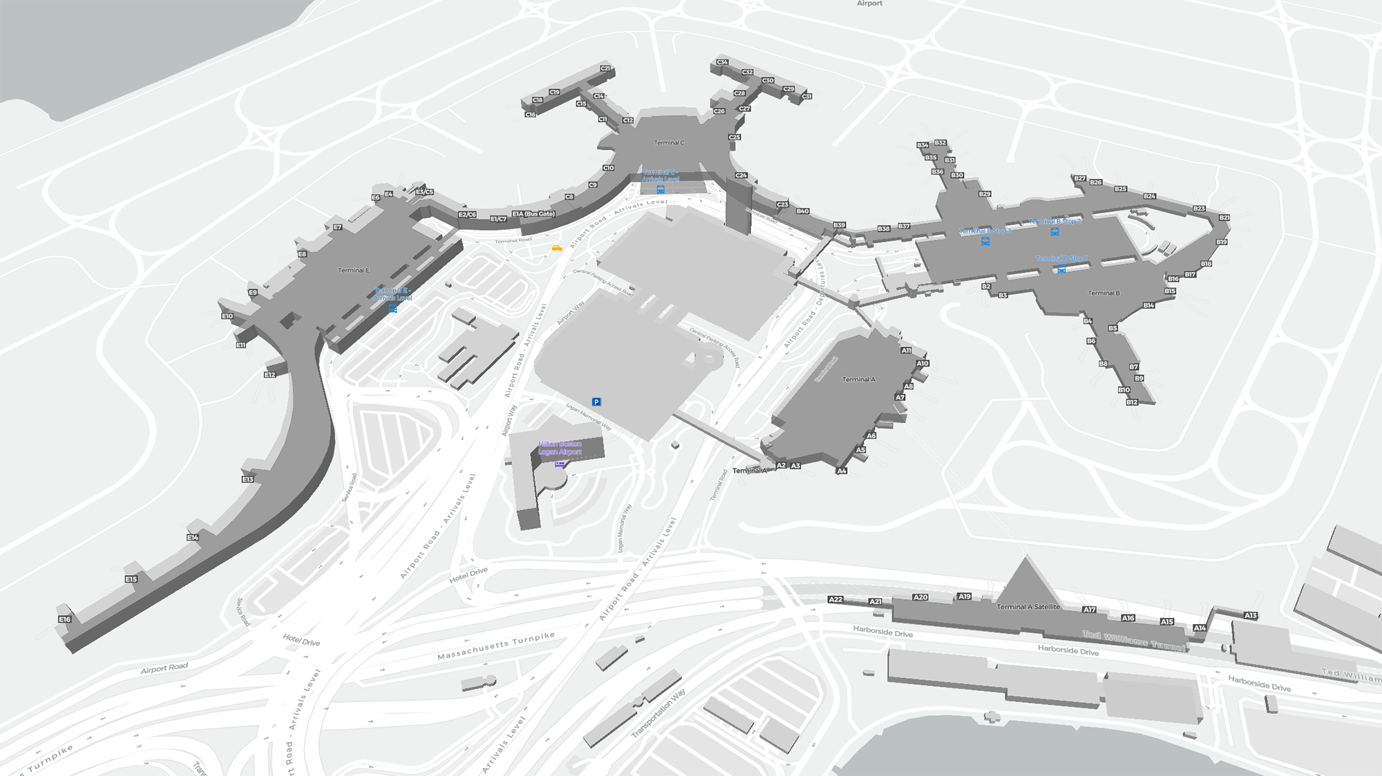
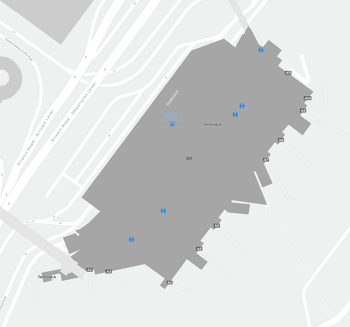
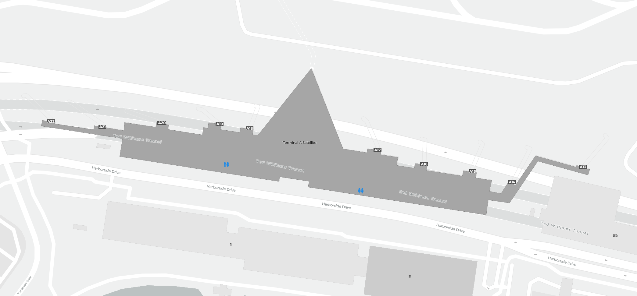
Terminal A
Terminal AS
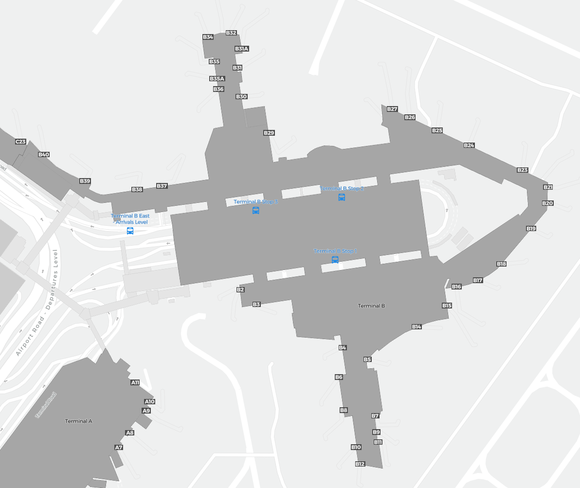
Terminal B
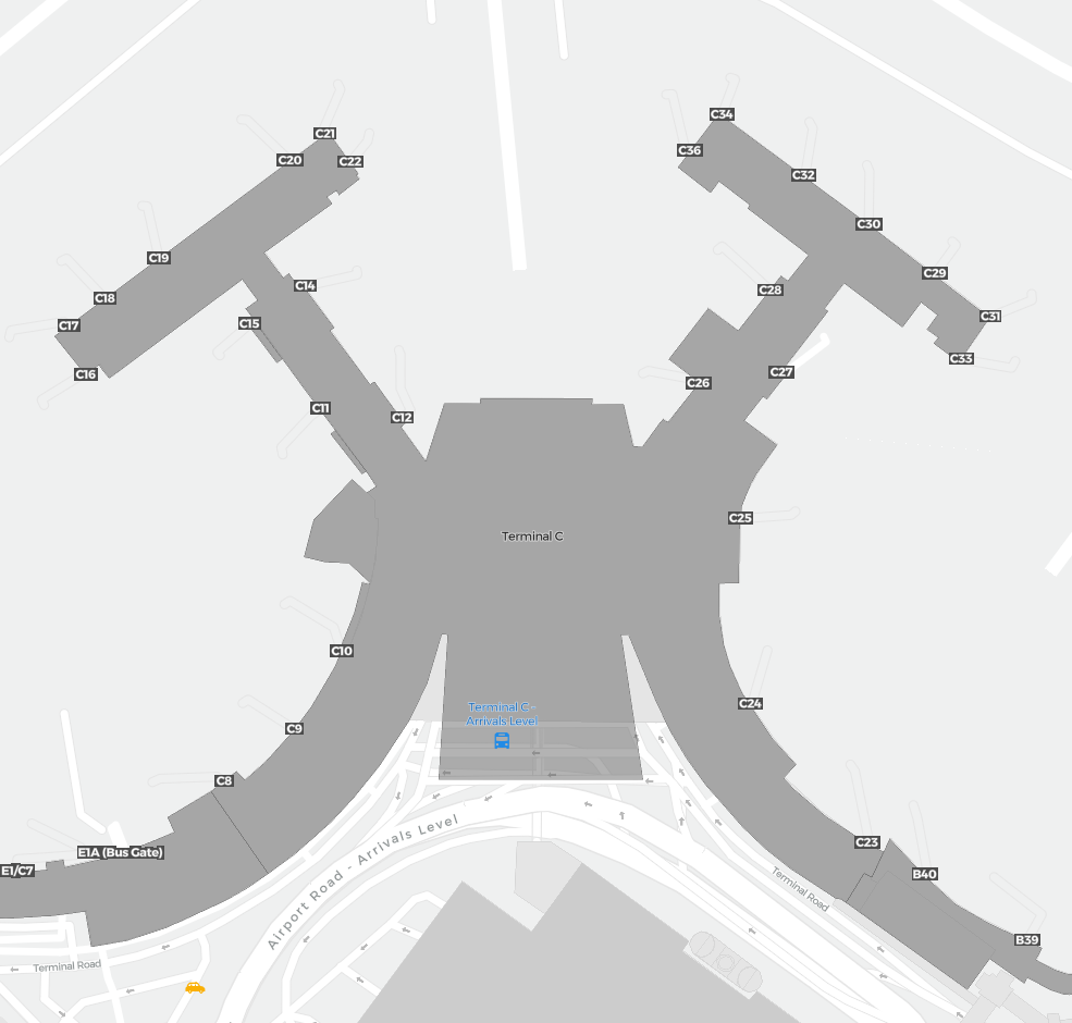
Terminal C
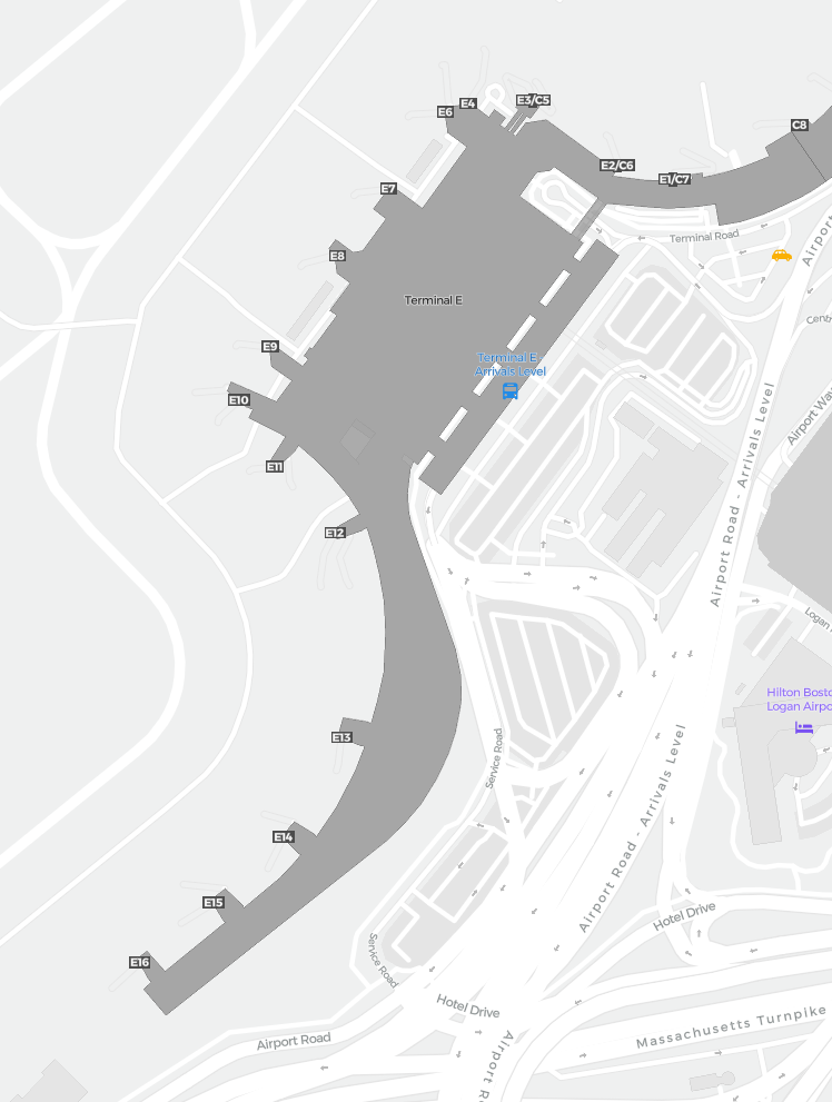
Terminal E
Interactive airport map
This is a zoomable map over Boston (BOS). The map can give you an overview of the outdoor area with terminals, parkings, and at some airports also details of gates, car rental facilities, and other amenities if you zoom in.
The map is maintained by the OSM community via open collaboration. Links to other map services:
Openstreetmap Google Maps (Satellite) Bing maps (Satellite) Google street viewRoutes & destination map
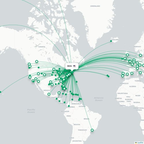
Map of all passenger routes from Boston (BOS). This airport has approximately 152 destinations.