---
---
--:--:--PM
--:--:--PM
Alfonso B. Aragon Intl (CLO) airport maps
Maps of Alfonso B. Aragon Intl, Colombia
Interactive airport map
This is a zoomable map over Cali (CLO). The map can give you an overview of the outdoor area with terminals, parkings, and at some airports also details of gates, car rental facilities, and other amenities if you zoom in.
The map is maintained by the OSM community via open collaboration. Links to other map services:
Openstreetmap Google Maps (Satellite) Bing maps (Satellite) Google street viewRoutes & destination map
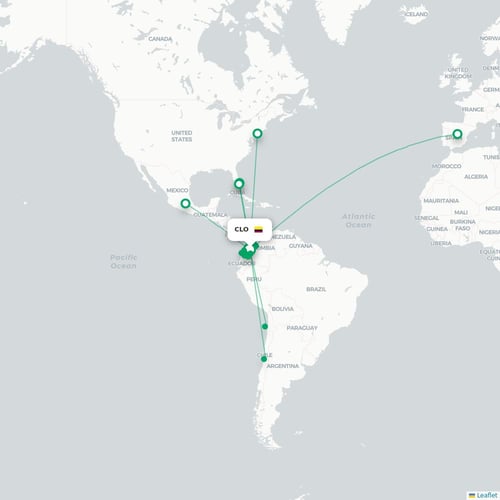
Map of all passenger routes from Cali (CLO). This airport has approximately 25 destinations.